Excavating near the Santa Barbara Canal versus off Skyline Boulevard presents two completely different problems in Cape Coral. One site is fighting seepage from the adjacent waterway, the other is cutting through dense shell hash and cemented sands that stand up nicely until they suddenly don't. We've instrumented both. The city's 400-plus miles of canals mean most deep excavations here intersect the water table within four to six feet of the surface, and that changes the monitoring game entirely. A project on SE 47th Terrace needs a different sensor array than one on NW 28th Avenue, simply because the subsurface stratigraphy shifts block by block across Lee County. Our excavation monitoring program covers inclinometers, piezometers, and optical survey targets—configured specifically for Cape Coral's shallow groundwater and loose-to-medium-dense Pleistocene sands. When the excavation goes below the canal level, we typically combine real-time groundwater readings with deep excavation instrumentation to track basal heave potential.
In Cape Coral, the difference between a dry excavation and a flooded one is often less than 18 inches of groundwater fluctuation.
Scope of work in Cape Coral
Typical technical challenges in Cape Coral
Cape Coral sits at roughly 5 feet above mean sea level, and the underlying geology is a layered sequence of loose sands, silts, and intermittent limestone stringers deposited during the Pleistocene. The city’s canal network, originally dredged in the 1960s and 1970s to create waterfront lots, has permanently altered the local hydrogeology. Water moves laterally through the connected canal system faster than it infiltrates vertically, which means an excavation three blocks inland can still respond to canal-stage changes within hours. The primary risk we track is basal heave in excavations below 10 feet. When the confining weight of the excavated soil is removed, the hydraulic pressure in the underlying sand can push the floor up and destabilize the entire cut. We've seen it happen on a commercial site off Del Prado Boulevard where dewatering wells weren't keeping pace with inflow from a nearby canal. Secondary risks include settlement of adjacent structures—many Cape Coral homes are slab-on-grade with shallow footings sensitive to ground loss—and raveling of the excavation face in zones where the sand contains intermittent shell layers that slough when exposed to moving water. Continuous monitoring closes the gap between the geotechnical assumptions in the design report and what the ground actually does during construction.
Our services
Our monitoring scope in Cape Coral typically bundles the following components. Each is configured for the specific excavation geometry and subsurface conditions encountered on your lot.
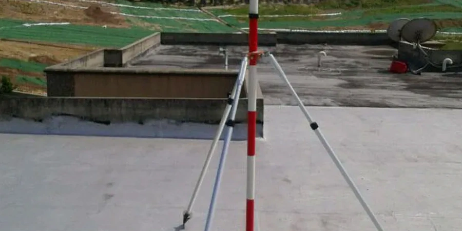
Inclinometer and Lateral Movement Monitoring
Casing installed behind the shoring wall or soldier piles, surveyed with a digital inclinometer probe. We plot cumulative deflection and rate against time, flagging any accelerating trend that suggests the retaining system is approaching its design limit.
Groundwater Monitoring and Dewatering Verification
Vibrating-wire piezometers at multiple depths track pore pressure response to dewatering pumps. Data is logged continuously and compared against the drawdown target specified in the dewatering plan. We provide daily hydrographs during the critical excavation phase.
Settlement and Heave Surveying
Optical survey monuments installed on adjacent pavement, structures, and within the excavation floor. Weekly level-loop surveys detect vertical movement before it becomes visible, allowing the contractor to adjust excavation sequencing or shoring before damage occurs.
Quick answers
How much does geotechnical excavation monitoring cost for a typical Cape Coral lot?
For a standard single-family lot excavation near a canal, monitoring programs generally range from US$740 to US$2,650 depending on depth, duration, and the number of instruments required. Deeper commercial excavations with automated dataloggers and multiple inclinometer lines run toward the upper end. We provide a fixed-scope proposal after reviewing the excavation plan and the geotechnical report.
What triggers a stop-work recommendation during monitoring?
We use pre-established threshold values based on the shoring design and adjacent structure tolerances. A cumulative lateral movement exceeding 1 inch or a settlement rate above 0.1 inch per day over three consecutive readings will trigger an immediate notification. If groundwater rises within 2 feet of the excavation base and dewatering cannot recover the target drawdown, we recommend pausing excavation until the system is adjusted.
How is monitoring different for canal-front excavations versus inland lots?
Canal-front excavations typically show faster groundwater response and higher sustained inflow rates because the canal acts as a recharge boundary. We install an additional piezometer between the excavation and the canal to measure the hydraulic gradient directly. Settlement monuments are also placed on the canal bank and adjacent seawall to detect any movement caused by drawdown. Inland lots, by contrast, are more influenced by seasonal rainfall and neighbor dewatering on adjacent construction sites.